|
|
|
|
|
|
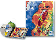
The PC-Atlas is an electronic atlas on CD-ROM by the National Atlas of Sweden. It is only available in Swedish, however these pages are provided as a service for those who would like to know more about the project. | |
|
The PC-Atlas is a GIS-based reference tool complete with lots of data - all available on a single CD. Data comes from a variety of sources and are based on the map production for the National Atlas books. The wide variety of data also presents a good overview of available spatial data for Sweden. A combination of table-of-content and free text-search makes it easy to navigate the more than sevenhundred maps and explore the their datasets. |
|
The PC-Atlas also include a gazetteer which is also available on the web - The Swedish Gazetteer. For more information about the PC-Atlas, please write to Mathias Cramér (info@sna.se) |